OUP walk: exploring the Hayward Fault


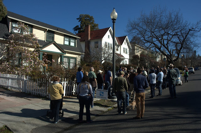
Saturday we had a record turnout for an Oakland Urban Paths walk, led by local historian Dennis Evanosky. About 125 people showed up to explore the traces of the Hayward Fault. We were joined by Andrew Alden, who has led geology-based OUP walks before, including an exploration of another part of the Hayward Fault last year.

We started the walk at the Redwood Heights Recreation Center, then headed down to 39th Avenue. One of the few residents in the area in 1868 lived nearby, but the great earthquake of 1868 was felt all over the East Bay and beyond. It was estimated to have been between 6.8 and 7.0 magnitude, and the shaking last 42 seconds. The worst damage was in Hayward, and there were 30 deaths including four in San Francisco.

Along 39th is an EBMUD reservoir, which was originally a “sag pond” formed by a depression along the fault. From there we headed north across 35th Avenue where Dennis told us more about local history. Many of the streets in the area are named for veterans of WWI.

Then it was up to Rettig Avenue along Peralta Creek. Part of Rettig is closed to automobile traffic because the effects of a landslide. A neighbor from the area told us about the slide and subsequent efforts to stabilize the hillside. A little further down the creek we heard from another neighbor about the efforts to clean up the area around the creek and make it into a park.

Up the hill, we came to the Kitchener Court landslide. After heavy rains in 1970, the entire area slid. First it damaged 14 houses, and eventually expanded to 22 houses. An even bigger concern was a fuel line carrying jet fuel from refineries to the Oakland Airport. A similar accident in 1969(?) in Canyon, CA, (just east of Oakland) raised serious concerns about a repeat on a larger scale in Oakland.

Then it was up hill past the Mormon Temple. We’d been there before on the Oakmore Highlands walk back in March, but approached from the other direction.

After a long downhill (and losing a few people to an estate sale in an interesting house), we returned to our starting point. Thanks to Dennis for leading the walk, and to everyone and everywoof who came out for it. And thank you for your patience as we worked out the bumps with the new sound system. Your donations are what made that possible, and help us with the mission of educating people about the urban paths, stairways and walkways around Oakland.

On a related note, did you know that Oakland was ranked the 9th most walkable large city in the U.S.? The hills definitely bring down Oakland’s score, but our beloved city is still a pretty darn walkable place. Oakland Urban Paths and Walk Oakland Bike Oakland are working to make it even more walkable and more livable. Thank you for your support in helping make that happen!

Additional Links:

map of our route (PDF)
Google Earth Tour of the Hayward Fault

Lots more pictures from the walk:

OUP walk: Old Oakland and West Oakland


A special thank-you to Robert Perricone and Fran Estrada for the use of their photos. For a variety of reasons, OUP was short-handed for Saturday’s walk, and I’ve found it difficult to lead a walk and take pictures of it at the same time, so I’m very grateful to them for the use of some of their photos.


These days it’s easy to think of Old Oakland and West Oakland as separate areas of Oakland because of the freeways, but in the past they were connected into one continuous neighborhood. Saturday about 35 people and two dogs joined Oakland Urban Paths for a walk exploring these areas.

Tina Tamale
photo by Robert Perricone

We started the walk in front of La Borinqueña Mex-icatessen, where Tina “Tamale” Ramos told us about some of the changes in the area. Tina is a 3rd generation Oaklander and 3rd generation running a business in Oakland, so she and her family have seen a lot of the changes over the years. Her mom, “Mama Tamale”, is retired from running the business, but still comes in on Saturdays and for special events, to give tamale advice and talk about the old days.

In front of Tina’s tamale shop is a marker for the 10,000 Steps Project. It’s an art project highlighting the historic parks of downtown Oakland. We passed by a number of other markers on the walk, including ones at Lafayette Square Park, the Pardee Home, and Jefferson Square Park. There are 37 markers total, and more than half of them have an associated audio segment, including interview clips with Tina and her mother.

We headed up to Lafayette Square Park, which was the original location of the Chabot Observatory. It was a gift of Anthony Chabot, who is probably best known as the founder of the water company that eventually became EBMUD. The observatory was in downtown Oakland from 1883 until 1915, when increasing light pollution from the growing city required a move to the hills.

A short walk from the park took us to the Pardee Home Museum. It was the home of Enoch Pardee, who was mayor of Oakland from 1876–1878, and later the home of his son, George Pardee, who was mayor of Oakland and later governor of California. Besides preserving the historic house, it also serves as a museum. George and Helen Pardee’s daughters, Madeline and Helen, lived in the house their entire lives, changing very little over the years, so it is well-preserved. George Pardee was also involved in the creation of EBMUD and somewhat indirectly the creation of the East Bay Regional Park District.

Across the street is Preservation Park. There are 16 historic buildings there, but 11 were moved from elsewhere to save them from the wrecking ball when the freeways were built. The park is now run by a private company and houses offices for different non-profits as well as a small restaurant. Unfortunately there was an event so the park was closed, preventing us from getting a closer look at the homes and at the Latham-Ducel fountain in the middle of the park.

First Unitarian Church
photo by Fran Estrada

Around the corner from Preservation Park is the First Unitarian Church. The lovely brick structure was damaged in the 1906 earthquake and again in the 1989 Loma Prieta earthquake. The church was started when Presbyterian pastor Laurentine Hamilton was charged with heresy for his teachings. He left the Presbyterian church, and much of the congregation went with him.

Our next stop was further away, on the other side of I-980. Blocks and blocks of homes and businesses were destroyed for the construction of the freeway, but some of the homes were saved and moved to Preservation Park. A block or so south of our route was the original location of Oakland High School, but it was gone long before the freeways came through.

We eventually came to de Fremery Park. The park is a hub of West Oakland, with a recreation center, picnic tables, tennis courts, and a skateboard park. It hosts a variety of events, including the annual Black Cowboy Parade, which has been around almost 40 years. Even more years ago than that, the Black Panther Party held rallies and food giveaways at the park. But originally it was the grounds of the de Fremery family house known as “The Grove”. James and Virginie de Fremery were a wealthy couple and had numerous descendants in Oakland. But what is less well-known is that Viginie was the child of a Dutch merchant and a former slave he purchased then later married.

We discussed gentrification and the broader sweep of West Oakland’s history. Although there were exceptions like William Shorey, the largest number of African Americans came to Oakland during WWI and WWII. Some had found work as Pullman Porters, and Oakland was the end of the line for the transcontinental railroad. Many settled in West Oakland, not necessarily because they wanted to, but housing covenants as well as unspoken rules made it so West Oakland was the only place they could live.

From there, we walked past the former site of the Miller home. Keeping with our earlier utilities theme, Albert Miller and his son C.O.G. Miller were involved in the creation of Pacific Gas & Electric. There were questions about the food mill across the street. Although there are no signs, it’s still an active business. It began back in 1915 as the Pacific Coast Shredded Wheat Company; now it produces organic rice flour, crisp rice, and corn flakes, most of which goes to Japan.

Cypress Freeway Memorial Park

To the west we came to the Cypress Freeway Memorial Park. More recent arrivals to Oakland may not know that where Mandela Parkway is now was originally the location of the Cypress Structure which collapsed in the 1989 earthquake. The park is a memorial to those who died, and features a sculpture recalling the twisted wreckage of the freeway, the dust rising from the debris, and the ladders that people in the neighborhood brought to help reach the victims. There is also a mural called “15 seconds” which is a trace of the seismograph of the main temblor of the earthquake. Unfortunately part of it has been damaged and painted over.

We headed down Mandela to 7th Street. We didn’t have time to walk there, but I pointed out where Esther’s Orbit Room and other music clubs in West Oakland made up what was once known as the “Harlem of the West“. Noted jazz and blues musicians from all the U.S. came to Oakland to perform, and some even got their start here.

We walked past The Crucible and talked about its art programs, as well as the Oakland Running Festival that passes through the area. Then it was down to Linden Street Brewery. The brewery itself is in a building that was originally cable manufacturing plant. But we were there to see the former location of the nearby Moore Dry Dock Company, which built ships including ferryboats for the Key System, as well as structural steel for projects like The Paramount Theatre, the High Street Bridge, and caissons for the Bay Bridge.

Our return journey took us past Urban Legend Cellars, one of Oakland’s wineries. Turns out one of the people on the walk works for a winery in Alameda [ sorry, don’t remember name ]. Both of them are members of the East Bay Vinter’s Alliance, which holds a number of fun wine events in Oakland and Alameda. Then it was through Jefferson Square Park and back to La Borinqueña. A number of us stayed for lunch and for a sneak peek of the new garden space behind the restaurant. It was featured the next day at the Viva Tamales! fundraising event.

Thanks to Tina for her hospitality, special thanks to Robert Perricone and Fran Estrada for the photos, and thanks to everyone and everywoof that came out for the walk.

October’s walk will be on the second Saturday, October 12th, and will feature the new Bay Bridge Trail and pathway.

Lots more photos from the walk:

OUP walk: Jingletown and the estuary


Saturday we had the biggest turnout ever for an Oakland Urban Paths walk, about 85 people and at least four dogs. We met at the north end of Union Point Park to explore Jingletown and along the estuary for one of the most ‘urban’ walks that we’ve done.

First we heard from OUP walk leader Chris Kidd about the creation of Union Point Park as part of Measure DD. In a clever cost-cutting move, instead of trucking contaminated soil off-site, they encapsulated it in a mound in the park. One of the sources of the industrial contamination was Cryer & Sons Boatyard, a historic business that now sits vacant, awaiting cleanup for public use. Probably the most famous boat built there was a 130-foot yacht for Cliff Durant of Durant Motors which built cars in East Oakland in the 1920s.

We walked through the park, with a brief stop at the “Sigame” sculpture, which remembers 20 women from Oakland’s history. Although we were following the Bay Trail, we came to our first departure from the waterfront. A grain mill currently owned by ConAgra still has access to the waterfront, plus there’s a concrete plant, and there are no crosswalks across 29th Avenue and the maze of streets near the Park Street Bridge.

We rejoined the Bay Trail by going through the Waterfront Lofts. Part of the agreement to build housing and develop the Bay Trail was to allow public access to the trail. So there’s a gate at each end of the lofts that allows people access between Glasock Street and the waterfront. Another part of the complex development was a land swap, which gave the Cal Crew a larger lot and moved part of the historic Ky Ebright boathouse.

We walked almost to the Fruitvale Bridge when we hit another obstacle. Although it has gates that are supposed to be open, a building near the bridge had locked gates that meant another detour. We walked up past the warehouse for the Oakland Museum of California’s White Elephant Sale, down a railroad right-of-way, and back down to the waterfront.

There we walked through the tiny Fruitvale Bridge Park, where Sausal Creek flows into the estuary. Across the street is the massive Owens-Illinois glass factory, one of the few heavy industries still in the area.

We continued along the estuary to High Street and stopped next to the High Street Bridge. At this point the Bay Trail goes away from the water again, through a heavily industrialized area. From there we backtracked, then went to explore Jingletown.

The Jingletown neighborhood is full of artists and art studios. But it’s also full of public art, with numerous mosaics gracing the walls of area buildings, and quirky sculptures and paintings awaiting the curious. We stopped by the Rue de Merde art wall, and some people headed over to Kefa Coffee for coffee or a snack, while the rest of us hung out in the shade in front of the Gray Loft Gallery or continued exploring the art wall.

After that, we headed back to our starting point in Union Point Park to finish our walk.

If you’re interested in the future of the Bay Trail, Waterfront Action is working to continue to improve the continuity and access for the Bay Trail as part of Measure DD. One big project remaining is the construction of paths around each of the three bridges.

Also of note, the folks at the historic Cotton Mill Studios in Jingletown will be having an open studio event called F3 on Friday, July 19th. It’s a chance to check out the work local artists and fashion designers, plus get a peek at the historic building.

Another great walk. Thanks to Chris Kidd for leading us, and to everyone and everywoof that came out for the walk. The next walk will be the usual second Saturday, on Saturday, August 10th at 10am. The location is yet to be determined, but you can check the website or sign up for the email list to get all the details.

Lots more pictures from the walk:

Additional links

OUP walk: Lake Merritt


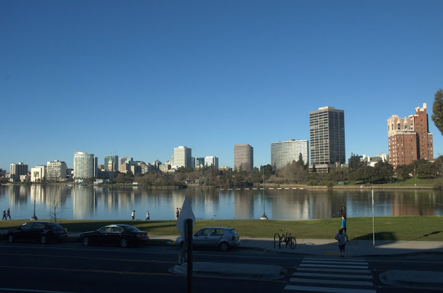
A group of 30 people and two dogs joined Oakland Urban Paths for a special Sunday urban paths walk around Lake Merritt. The walk was on Sunday instead of our normal Saturday so people could also participate in the Love Our Lake / Oaklavía celebrations going on around the lake. The streets around Lake Merritt were closed to cars and opened to pedestrians, bikes, scooters, skaters and more so people could check out all the improvements around Lake Merritt that have been done as part of Measure DD.

We started the walk in Snow Park, where food trucks and others were already getting set up for the day’s events. Snow Park is named for the Snow Museum of Natural History; adventurer and hunter Henry Snow shot and otherwise collected thousands of specimens and gave them to Oakland to start a museum. Later parts of the collection would be folded into the Oakland Museum of California.

Next door to Snow Park are the remains of the Schilling Gardens and estate, the home of Schilling Spice Co. founder August Schilling. Parts of the gardens still exist, including iron gates with a large ‘A’ and ‘S’ in their design, as well as part of a greenhouse. The gardens and grounds were beautiful, immortalized in postcards and open to the public until about 1911. Now they’re closed to the public, and were recently threatened by the development of a 42-story building.

After a quick stop in front of the Lake Merritt Hotel and The Terrace Room, we rounded the corner on Lakeside Drive to come to the Municipal Boathouse. It started as the a pumping station for the Oakland Fire Department in 1909. The 1906 earthquake was devastating not only because of the ground shaking but because of the massive fires that followed. The pumping station was added as water supply in case of a similar event in Oakland. The wings with the boathouses were added in 1913, and after getting rundown over the years, the building was retrofitted to house the Lake Chalet restaurant, a gondola service and the Lake Merritt Rowing Club.

A short walk brought us to Camron-Stanford House. This historic home is the last of the grand Victorians that once ringed Lake Merritt. It was home to various families, including the Camrons, the Stanfords, and the Hewes. For many years it housed the Oakland Public Museum. After that was merged into the new Oakland Museum of California, the building became rundown and was threatened with demolition. A group worked to save the house, and now it houses a small museum as well as offices that are rented out. The house and grounds (which include a new Victorian period garden) are available for rental for events like weddings or parties. While we were there, Mayor Jean Quan stopped by to take our picture. That seems only fair since we’ve walked past her house on a previous walking tour.

Then we walked along the south end of the lake, past the Kaiser Convention Center (formerly known as the Oakland Auditorium) to the channel to the estuary. There we looked at the remaining traces of Peralta Playland, which include part of the tunnel from the miniature steam train, the Oakland Acorn. There we ran into Robert Raburn who is on the BART board and founded the East Bay Bicycle Coalition, and Naomi Schiff, who is on the board of the Oakland Heritage Alliance and has been active with it since its inception.

A longer walk took us up to the Cleveland Cascade. The beautiful cascade was built in 1923, and was operational until some time before 1950. Over the years it got more and more overgrown, and eventually became a neighborhood nuisance. Then in 2004 some neighbors decided to clean it up, and rediscovered the cascade. Now the Friends of the Cleveland Cascade have raised money (including some Measure DD funds) and installed new railings and lighting on the stairways, and are hoping to raise more money to make the fountains operational once again. Now the stairs are some of the most heavily used in Oakland, both for people getting access between Lake Merritt and Cleveland Heights, but also just for exercise.

We walked around the north end of the lake, through the Oakland Pergola and Colonnade. While it didn’t get as rundown as the Cleveland Cascade, it needed some renovation via Measure DD, too. When we went past there were people dancing in the plaza and valet bike parking along sidewalk. The adjacent street is called El Embarcadero because in the days of the Spanish, it was used as a landing for shipping and receiving cargo by boat.

Heading south, we saw the islands that serve as a refuge for birds. In fact, Lake Merritt is the oldest wildlife refuge in the United States. It became one when Governor Henry H. Haight signed a bill in 1870. The lake is still a wildlife refuge, although the Canada geese are some of the more controversial avian residents.

From there we headed to the Gardens at Lake Merritt. Volunteers were doing special tours as part of the Love of Lake celebration, and to encourage people to volunteer to help with the maintenance. The 11 gardens include a bonsai garden, a sensory garden, a palmetum, and more.

On the other side of the gardens, we passed by the Lake Merritt Bandstand, the back of Children’s Fairyland, and around the arm of the lake. From there we could see the outflow of Glen Echo Creek, the Cathedral of Christ the Light, the Kaiser Center, the Kaiser Roof Garden, and our starting point, Snow Park.

Another great walk. Thanks to everyone who came out and joined us!

More photos from the walk:

Click for a map of our route.

OUP walk: Piedmont and the Rose Garden


In honor of Mother’s Day, the Oakland Urban Paths walk on Saturday trekked through Oakland and Piedmont, and included a stop in the Morcom Rose Garden where celebrations for the Oakland Mother of the Year Award were going on. About 35 people and 5 dogs joined us for an unexpectedly warm walk on stairways in Lakeshore, Grand Lake, and Piedmont.

We met in Mandana Plaza to begin the walk, then headed up Lakeshore Avenue. At our first stairway, Paul talked about the Key System and how many of the stairways and pathways around Oakland were built to give people in the neighborhoods better access to the streetcars. The different lines of the Key System were assigned letters and unique symbols so that riders could see which train was coming from a distance.

I pointed out a cast-iron lamp on the stairway which has a lot of history in a little stamp near the base. The lamp was made by the Joshua Hendy Iron Works. The company was originally based in San Francisco and later Sunnyvale. They manufactured mining equipment, valves and control gates for such projects as Hoover Dam, but were probably best known for manufacturing marine engines for hundreds of Liberty ships during WWII.

Chris and Tim’s garden

Our wanderings took us up and down more stairs, past lots of gardens, flowers and lovely homes, and eventually into Piedmont. And then right back into Oakland. In an OUP first, we got to tour one of the gardens, thanks to Tim and Chris (who is on the Walk Oakland Bike Oakland board). They graciously invited us in to see their garden, which is full of native plants with a particular eye to attracting wild bees. Their cat was understandably less pleased about the presence of the dogs in our group. Tim didn’t have time to talk about it while we were there, but the garden also features a gray water system as well as a barrel for rainwater collection.

Then it was back into Piedmont, and time for some confusion. When I tested the walk route, I didn’t go through Tim and Chris’ yard, but took a slightly different route around to the next point. As a result, I wasn’t able to help when there were doubts about where to go on the route next. Things got more interesting because I got my bearings and proceeded to tell some people where the correct route was, and that while most of the group had backtracked a bit, we’d meet up shortly. So, about that… We backtracked further than I’d expected, so we didn’t rejoin the people I’d directed down the correct route. After a bit of running around, I found the sub-group and lead them on to the rose garden where we rejoined the main group.

Morcom Rose Garden

At the Morcom Rose Garden there were ceremonies for the Oakland Mother of the Year Award. It’s been given annually since 1954, to honor people in the community who “symbolize the finest traditions of ‘motherhood’.” This year’s winner is Annalee Allen, who writes a history column for the Oakland Tribune and also leads the city of Oakland’s downtown walking tours program. I ran into lots of folks from the Oakland Heritage Alliance who were there to celebrate Annalee’s award, as well as Robert Raburn of the BART board. Mayor Jean Quan and councilmember Lynette Gibson McElhaney were there, too.

After we left the rose garden, we climbed up Jean Street so we could descend some stairs down to Grand Avenue. After crossing Grand, we admired the mural at the foot of the Davidson stairs, then climbed up the stairs to Vernon Street. There we viewed the back of the Grand Lake Theater sign, and Paul told us a bit about that. The sign has 2,800 colored bulbs, and is the largest rotary contact sign west of the Mississippi. The light sequence is controlled by a device not unlike a music box.

Then we descended back to our starting point on Lakeshore Avenue. Another great walk—thanks to Paul for leading it, and to Tim and Chris for letting us tour their garden. And thanks to everyone and everywoof who came out for the walk. The next walk will be Saturday, June 8th at 10am. The walk is still being finalized, but will likely be along the waterfront. Hope to see you out there!

Lots more pictures from Saturday’s walk:

OUP walk: Parklets


Saturday was the monthly Oakland Urban Paths walk, this time focused on Oakland’s parklets. A ‘parklet’ is taking over one or two parking spaces and making them available to people, by extending the sidewalk into a seating area. The walk was led by Chris Kidd of OUP and Ruth Miller, an urban planner who was instrumental in getting parklets introduced to Oakland when she worked with Walk Oakland Bike Oakland. We were joined by 40+ people and half a dozen dogs.

The first known parklet of was an art project by Rebar Art and Design Studio in San Francisco in 2005. They rolled out sod, set down a potted tree, and to keep things legit, fed the parking meter as needed. That’s how a number of cities have gotten into it, with parklets as temporary structures. Read about Park(ing) Day 2011 in Oakland.

The first official and more or less permanent parklet was in 2010 in San Francisco. Oakland got into the swing of things, and now has two parklets, with more in the works. We started our walk at the first permanent parklet, outside Farley’s East. Chris and Ruth told us a bit about parklets, and then we headed uptown.

At 28th and Broadway, we headed over towards Glen Echo Creek. These days it’s largely underground, but given the topography it’s pretty easy to figure out about where it is. We climbed stairs on the other side of the creek, past the historic First Christian Church, to Oak Park. While it’s an official city of Oakland park, it doesn’t feel a whole lot bigger than a parklet. It’s part of what was a school that was converted into condominiums.

Back down the hill, across Glen Echo Creek, under I-580 and around some corners, and we crossed Glen Echo Creek again. We headed up to Piedmont Avenue, and then beyond to Howe Street and 40th. There’s an odd set of streets, with 40th Street running into 40th Street Way, and 40th Street itself continuing half a block to the southwest. The odd bit of street layout is because 40th Street used to be a cut through the hill that the Key System followed. The tracks then curved around to the northeast, and into what is now the Key Route Plaza that we saw on our December Walk and Shop.

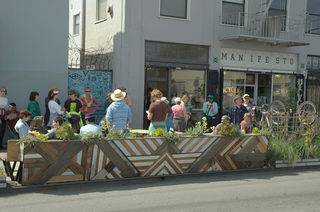
Then it was down 40th to Manifesto Bicycles and the site of the second permanent parklet. We heard more about parklets, what’s involved in creating them, and what’s planned for the future. Several more parklets are in the permit and build process, including one on Lakeshore and one outside Actual Cafe at Alcatraz and San Pablo, as well as one on 25th Street between Telegraph and Broadway. From there people could either walk to Broadway to catch a bus, walk straight down Broadway for a quicker walk back, or stick with us for a few more meanderings. We went through Mosswood Park, back across Broadway, and across Glen Echo Creek one more time.

Another great walk. Thanks to Chris and Ruth for leading it, and to everyone and everywoof who turned out for it! Check the Oakland Urban Paths website for details on the next OUP walk, which will Saturday, May 11th at 10am. Hope to see you then!

Lots more pictures from Saturday’s walk:

OUP walk: Oakmore Highlands


Saturday we had perfect weather for the largest ever turnout for an Oakland Urban Paths walk. There were 70+ people and at least 6 dogs who joined us to explore Oakmore Highlands and Sausal Creek.

streetcar crossing the bridge
photo from Oakmore Homes Association

We started by crossing the Leimert Bridge. It was built in 1926 by developers Harry and Walter Leimert so they could develop Oakmore Highlands. It originally had Key System streetcars running over it as well as cars and pedestrians. In 1947 the poles used for supporting the streetcar power lines were converted to street lighting. The 117-foot high concrete arch bridge was designed by engineer George Posey, who also designed the tube to Alameda.

Back across the bridge, we headed up the Bridgeview Path stairs. The stairs were built when the original development was, but had fallen into disrepair. After some resistance from the city, they finally agreed to fix them up, with the proviso that the homeowners keep them clean. In 2005 there was a ribbon-cutting ceremony for the reopening of the stairs. Compared with many stairs around Oakland, these ones are now in great shape, with repaired concrete and new railings.

We walked up and down more stairways, and I pointed out the WPA stamps in one set that date them to 1939. I also pointed out some sidewalk stamps, and mentioned Andrew Alden‘s method of estimating the age of a neighborhood. Up several streets, passing lots of beautiful homes and some lovely views, we made it to the high point of our journey. The house there is marked by a mailbox labeled “Hilltop House”. We even saw a red-tailed hawk soaring overhead. Past more houses (including that of Mayor Jean Quan) we came to a dirt path at the end of a cul-de-sac. That led us to some wooden stairs, which led us to the back of the Mormon Temple property.

Mormon Temple

Before touring the grounds, we talked a bit about the temple. The temple was built in 1964, and a NY Times article a few years ago said it has an approximately $35,000 per month electric bill. If you’ve ever seen the temple at night, it’s not hard to see why—the brightly-lit temple is visible from all over the Bay Area at night. One of our walkers who lives not far away related two things: (1) the light from the temple is bright enough to light up her house (2) back during the rolling brownouts, the temple complied with requests to power down to ease the demand on the electrical grid. The FAA quickly requested they turn the lights back on, because the temple is used as a landmark for pilots flying under visual flight rules (VFR). We walked across the immaculately maintained grounds, and then to the base of the temple to take in the views.

Then we headed to Monterey Blvd. which parallels highway 13. A short, unexpected tunnel led us under the freeway to the corner of Joaquin Miller Park, and the former site of Camp Dimond. It was a Boy Scout camp from 1919 until 1948, and along with cabins and other permanent structures, it featured a 300,000 gallon pool with a special sand filtration system.

We headed back under the freeway and down to the trail head for the Bridgeview Trail. There, volunteers with Friends of Sausal Creek were finishing up a morning of working to restore and protect the watershed. The trail descends to the creek and back up the other side of the canyon, then is relatively flat, running almost down to the bridge where we’d started. But it was quite a change from the streets and stairs we’d been on up to that point.

Thanks to everyone and everywoof who came out for the walk. I hope you had as much fun on the walk as I did leading it! Special thanks to area resident John Tuttle who told us about the history of the Leimert Bridge and Oakmore Highlands, and to Megan from Friends of Sausal Creek who told us about the work that FOSC does to restore and protect the watershed.

The next Oakland Urban Paths walk will be Saturday, April 13th. We’ll be exploring Oakland’s parklets.

Lots more pictures from the walk:
OUP walk: Lakeshore to Park Blvd.


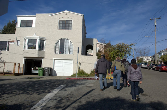
We had another great turnout for Saturday’s Oakland Urban Paths walk from Lakeshore to Park Boulevard. The number of participants has been growing steadily over the last couple of years. When Paul led this walk in January, 2012 we had 18 people and 3 dogs; Saturday we had 50+ people and at least 4 dogs. (Though to be fair, the weather wasn’t as good that day as the gorgeous weather we had Saturday.)

We started on Trestle Glen near Lakeshore Ave. near one of the ornate gateposts that date back to the early 1900s when the area was first developed. The streets were laid out by the Olmstead brothers, and some of the houses designed by noted architects Julia Morgan and Maybeck & White. You may recall that Mt. View Cemetery was designed by Frederick Law Olmstead, the father of the Olmstead brothers. Read more about the history of the Lakeshore area on the Lakeshore Homeowners Association (LHA) website.

Then we headed up Mandana Blvd. and up our first set up stairs into Oak Grove Park. It’s a privately-owned park between lots on Mandana and Longridge. Heading back across Mandana, it was time for stairs, stairs, stairs! Some of these stairs I worked on last fall with a group Oakland Pathways Volunteers to clean them up. This is exactly the sort of neighborhood effort Oakland Urban Paths would like to see all around Oakland. While the cleanup efforts have made the steps a lot easier to navigate, there’s still a lot of work to be done on some of them to repair the steps themselves.

The neighborhood is known as Trestle Glen, for the rail trestle that once crossed the canyon to Sather Park. That was built in 1893 by F.M. “Borax” Smith, the real estate magnate of the Realty Syndicate who eventually developed the Key System. Before that it was known as Indian Gulch, named by early Anglo settlers for the seasonal Ohlone village there.

We then walked into Crocker Highlands, once part of the William H. Crocker (son of Charles Crocker of the “Big Four”) estate. The area is full of beautiful homes, many also dating back to the original development. That was started in 1911 by Wickham Havens, son of Frank Havens of the Realty Syndicate.

Going up and down lots more stairs and some hilly streets, we eventually reached Park Boulevard, and stopped for a coffee break and for people to catch their breath after all the climbing to get there. We returned to our starting point by a different set of stairs and streets, and many people headed off in search of lunch on Lakeshore or nearby Grand Avenue.

Another great walk! Thanks to everyone and everywoof who came out to join us. The location for the OUP walk in March hasn’t been set yet, but it will be on Saturday, March 9th (the 2nd Saturday, as usual).

Lots more pictures from the walk:
Let me know if you have photos from the walk you’d like to share.

OUP Walk: Cleveland Heights and “Borax” Smith


Saturday we had an amazing turnout for the monthly Oakland Urban Paths walk. At least 65 people and 7 dogs joined us for a walk exploring Cleveland Heights and the site of the former “Borax” Smith estate. It was a chilly but beautiful morning, and the view over Lake Merritt was breathtaking.

We started the walk at the Cleveland Cascade. Designed by landscape architect Howard Gilkey in the 1920s, the cascade had 3 levels of 7 steps each. Each step had a bowl that made a curved sheet of pouring water. At each side were shell-shaped brackets, behind which were lights running through the colors of the rainbow. Over time, the cascade and nearby steps became rundown and overgrown. Barbara Newcombe was part of the original group that helped rediscover and uncover the stairs back in 2004, and was there on Saturday working on the stairs. Since 2004, the Friends group has cleaned up and maintained the stairs, installed new railings and LED lighting, and created new fixtures that will be installed when enough money has been raised. These days the stairs are heavily used, by people walking between Cleveland Heights and Lake Merritt, by people exercising, or just looking to get a different view of the lake. Read more about the Cleveland Cascade from in last year’s OUP: Jane’s Walk.

We walked up the steps along the Cascade and around to Cleveland Street. Area maps show a right of way between the top of the Cascade and Cleveland Street, but there are no signs that steps were ever built there. The question of “what neighborhood is this?” led to questions about the boundaries of Cleveland Heights, other names for smaller areas within it like Haddon Hill, and the general question of “what’s a neighborhood?” The main take-away is that neighborhood boundaries are fuzzy at best. Even though my Oakland Neighborhoods map has clear boundaries, the reality is that it depends on who you ask.

Along our way east, we admired some of the beautiful houses and apartment buildings, pieces of street art large and small, and of course I was checking out sidewalk stamps. They can give clues about the age of a neighborhood.


We crossed over Park Boulevard into Ivy Hill and Bella Vista, which is where the “Borax” Smith estate was. Francis Marion “Borax” Smith made his fortune in borax mining, and coined the slogan “20 mule team borax” which is still in use today. Smith is better known in Oakland for creating the Key System of streetcars. He and his business partner Frank Havens created the Realty Syndicate and bought large pieces of land then sold smaller pieces for development. To get people out to see the real estate, Smith bought up various streetcar lines and combined them into what became known as the Key System. To encourage people to visit, destination resorts like the Claremont Hotel were built. Traces of the Key System can be found all over Oakland, sometimes in subtle ways. Sometimes they’re still there, like the Claremont Hotel, and the Realty Syndicate building at 1440 Broadway. We were fortunate to be joined by Dorothy Lazard, head of the Oakland History Room at the main Oakland Public Library who told us more information as we went along.

Further along, we saw another wayfinding mark: a row of palm trees. They mark one edge of the Smith estate, which was known as Arbor Villa. The house itself was called Oak Hall, and was extravagant. It had 42 rooms, including 15 bedrooms; a ballroom; a bowling alley including a ball return; an organ with 18 or more ceiling-height pipes; an attached conservatory; and even a miniature borax mine. The 50-acre grounds were equally impressive, with a 5-story tower with an observatory; a large lily pond; a paddock where deer were kept; stables; several greenhouses; and a variety of guest houses and other structures.

I was inspired by what I’d learned on the Oakland Heritage Alliance “Borax” Smith tour and the bits and pieces I found online preparing to lead Saturday’s walk. So Sunday afternoon I joined other like-minded Oaklanders at the Oakland History Room and did more research on Arbor Villa. I’ve started an Oakland Wiki page about Arbor Villa, and will be updating it as time permits. Other things I learned about where the existence of an archery range, a small man-made cave called “The Grotto”, a cattery(!), and various gardens. Because one information source were the Sanborn Maps, which were created to estimate fire insurance rates, I also found other details, like the observatory tower contained a 10,000 gallon water tank.

We crossed back over Park Boulevard, but we weren’t done with the Smiths yet. Frank and his wife Mary donated money for the building of the El Campanil at Mills College. Mary was inspired to help children. After reading Benjamin Farjeon’s Blade O’ Grass about orphans in London, she took in various orphan children. Frank gave 34 acres of land across from Arbor Villa, and endowed the Mary R. Smith Trust for her to start a “home for friendless girls”, AKA orphans. “The Lodge” (a home that’s still there) at the center served as the intake office. Eventually 13 cottages were constructed for the girls to live in, and each cottage was given an endowment. A larger structure called the Home Club was constructed where Oakland High School is now, and served as a central clubhouse for different activities.

Along Park there is stairway that goes up the hill between several apartment buildings. Although it was a public right-of-way, it’s no longer publicly accessible. The stairs are also where a long, arbor-covered stairway went up the hill to the Home Club. A little further along Park is large home, which was one of the 13 cottages and was designed by Julia Morgan. Some of the other cottages still exist, and were designed by such notable architects as Bernard Maybeck and George W. Flick.

Our journey back took us across Haddon Hill, past more beautiful homes, apartments, and church buildings. Of particular note was a large home that was owned by noted industrialist Henry J. Kaiser. He started Kaiser Aluminum, Kaiser Shipyards (which built tons of ships during WWII) and what eventually became Kaiser Permanente, the first HMO. I’ve heard that Franklin Delano Roosevelt stayed there at least once while in the SF Bay Area.

Across the street is a stairway at the end of Haddon Road. As recently as 30 years ago, it was open and accessible. Now it’s blocked off by fences, and overgrown by trees and other plants. While it’s sad to see public stairways cut off, but it’s also understandable when an area wants to restrict easy access from some streets. It was doubtless very different before the MacArthur Freeway (I-580) was built, but now that section of MacArthur feels somewhat orphaned because it’s cut off by the freeway.

Our final stairway took us down from Merritt Avenue down to Beacon Street. It’s another historical staircase, and beautifully if somewhat impractically designed. Each section of stairs has a different design, whether curved, bay-shaped, or straight. They’re also smaller than would be permitted under current building codes. Fortunately a neighbor at the top of the stairs warned us that several of the steps at the bottom were broken, so we proceeded down with extra caution. I reported the problem with SeeClickFix, an online system for reporting potholes, vandalism, and other problems for the Public Works to address. If you’d like to help fix the problem, click here and vote.

More pictures from Saturdays walk:

Special thanks to Chris Kidd for the use of some his photos. I’ve discovered that leading a walk (particularly a large one) makes it harder to take pictures of the walk. If you have pictures of the walk you’d like to share, let me know.

Those of you who had difficulty hearing me talk (which is probably all of you at some point) will be happy to know we’re going to use your generous tips to invest in a portable sound system so large groups can hear better.

Related links:

Thanks to everyone who showed up! Hope to see you at the next Oakland Urban Paths walk, which will be the second Saturday, February 9th. The location is yet to be determined, but it’ll be in Oakland and it’ll be fun!

OUP Walk: Walk and Shop III


Saturday there was a small but enthusiastic group for the third annual Oakland Urban Paths ‘Walk and Shop’. We started on Lakeshore in Mandana Plaza and had beautiful weather for our walk.

We walked up the hill to look out over Lake Merritt past the Grand Lake Theater sign, and talked a bit about signs and urban paths. Some paths have street-like signs, some have other signs, but many have no signage at all. Since our walk was going to take us from Oakland into Piedmont and back, I told people about how to tell what city you’re in based on the style of street signs.

We crossed over Grand Avenue and up some stairs then down Jean Street to the Morcom Rose Garden. It’s named for Fred Morcom, the mayor of Oakland in the early 1930s who led the creation of the garden. The Friends of the Morcom Rose Garden, better known as the “Deadheaders”, were out in full force working on the roses. While it’s a city of Oakland park, volunteers do a lot of the maintenance. They’re out every second Saturday if you want to join them.

Then we walked through the park to Piedmont, where Paul pointed out the different street signs when we were in Piedmont. Never straying far from the Oakland border, we headed towards the Mountain View Cemetery. I told people about the tours there and the Oakland and California history there is to learn about. Docents at the cemetery lead general tours every 2nd Saturday and tours focused on different topics every 4th Saturday.

From there we were officially on our own for a while, to give people a chance to shop and wander at their own pace. I browsed a few shops, then stopped for a snack at La Farine bakery.

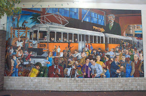
After that we met up at the Key Route Plaza. It’s named that because it used be a car barn for the Key Route. There’s a plaque and a lovely mural to commemorate the Key Route trains that used to run through there then up Piedmont Avenue. The mural is by artist Rocky Baird, who also painted the nearby mural on the side of Gaylord’s Coffee Shop. It features Key Route train #159, which last left the station at 6:45pm on April 19th, 1958. The mural is full of meanings, starting with the obvious figure of F.M. “Borax” Smith who created the Key Route to get people out to see and hopefully purchase his real estate. But the people pictured riding in car #159 were some of the donors, and there are other figures of note through the image as well. Read more at Oaktown Art and on SFGate.com.

We followed and crossed Glen Echo Creek towards downtown. Then it was up more stairs to Oak Park, more stairs and walkways past Harrison and Oakland Avenue, into Adams Point. Past some graffiti and a gnome or two, we crossed over I-580 and walked to the Grand Lake Theater. From there people headed to the Farmers Market, shopping on Grand Avenue or Lakeshore, or back towards home.

Another good walk, with lots of interesting bits and pieces to learn about Oakland and its history. Thanks to everyone who came out for it!

Lots more pictures from the walk:
Links to some of the things I mentioned: